
Illyricum on Biblical and Historical Maps
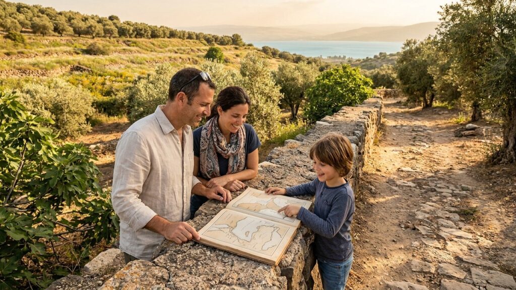

Illyricum appears in classical sources as a Roman province on the eastern side of the Adriatic. This short article describes how mapmakers from antiquity through the medieval period represented the area, and how the single biblical reference to Illyricum relates to that cartographic record. The language is kept straightforward for readers who prefer direct, plain explanations.
Maps from different eras place Illyricum along the eastern Adriatic shore. On some maps it covers a wide coastal zone; on others it is a smaller administrative district. Comparing these maps helps historians trace changes in names and boundaries over time.
from the Western Wall to Masada.
Overview
Illyricum was an administrative region of the Roman world. It lay along the western Balkans and included both coastal and inland areas. Modern national borders do not match the old provincial lines. Generally, the province covered territory that is now part of several states on the eastern Adriatic.
Roman writers and later geographers described Illyricum in different ways. Over time the Romans divided the area into smaller provinces or attached parts of it to neighboring districts. That created variation in maps and lists of places.

Illyricum in the New Testament
The New Testament includes a single mention of Illyricum. In Romans 15:19, Paul writes that he has “fully proclaimed the gospel of Christ from Jerusalem all the way around to Illyricum.” This line is brief and does not list towns or churches.
Scholars use this verse as one geographic note among many ancient sources. It suggests that the region fell within the scope of early Christian activity tied to Paul’s travel routes, but it does not provide detailed local information.
Geography and Landscape
The province combined coastal plains, river valleys and mountain ranges. Coastal areas were easier to reach by sea. Inland zones were steeper and less accessible.
Major rivers such as the Drin and the Neretva flow through regions that historians often associate with Illyricum. On surviving maps, river lines and the coastline help locate the province even when town names are missing.

How Mapmakers Represented the Region
Sources for ancient maps are not all the same. Some survive as written lists of provinces and routes. Others exist as schematic maps made for officials or soldiers. Later copies and medieval mapmakers add further variation.
Ptolemy’s Geography and Roman travel lists, called itineraries, are common starting points for study. Medieval map collections sometimes copied older divisions but also used local naming practices. As a result, no single map gives a final picture of Illyricum for every century.
Roads, Ports and Communication
Routes that linked Italy to the eastern provinces passed near or through parts of Illyricum. The Via Egnatia is one well-known east-west road that figures in many ancient accounts and maps.
Maps showing road networks help explain trade and movement. Ports on the Adriatic connected sea travel with inland routes. For practical mapping, roads and ports are useful points when place names are unclear or missing.
Some itineraries record distances between stops. These lists help modern researchers estimate the locations of towns that no longer exist or whose names changed. Such distance data can narrow down which coastal areas belonged to Illyricum at given times.
People, Languages and Administration
Ancient accounts describe a mix of local groups and settlers in the region. Greek-speaking communities, Illyrian tribes and Roman officials appear in different records. Administration usually followed Roman practices once the province was organized.
Place names in Greek, Latin or later Slavic sources can look different in manuscripts. Scholars often list variant forms to help readers follow how names changed over time. When reading maps, expect multiple spellings for the same site.
Archaeological finds such as pottery, coins and inscriptions let researchers test how a map’s labels match real sites. Coins and inscriptions that name a city or official are particularly useful for linking a map to the ground.

Archaeological Methods and Dating
Excavations in areas tied to Illyricum have produced urban remains, pottery and coins. Specialists date these items by style, by where they were found, and by inscriptions when present.
Archaeologists publish reports and articles that document finds. Such publications provide the evidence that mapping projects use to place ancient sites on modern maps. Readers should remember that new discoveries can change earlier conclusions.
from the Western Wall to Masada.
Classifying a site as “Illyrian” or “Roman” may depend on burial customs, building styles and material culture. Researchers use established procedures to date layers and to identify influences when possible. When evidence is weak, scholars describe their identifications as tentative.
Some finds are securely dated by inscriptions that include names, official titles or dates. Other material lacks such clear markers and must be interpreted in a wider regional context.
Changes Over Time
Administrative borders shifted under Roman and later Byzantine rule. Medieval maps reflect further changes in naming and focus.
Because political geography evolved, a town that appears in one century’s map may be placed in a different province on a later map. Historians therefore compare several sources to reconstruct the likely layout of the region at different dates.
Language changes also affect labels. A place recorded in Greek may appear differently in Latin or Slavic records. For clarity, many studies include lists of variant names and an explanation of which form they follow.

Modern Study and Tools
Today, historians use texts, inscriptions, coins and surveys to place Illyricum on historical maps. Critical editions of ancient writers and annotated map collections are common tools in this work.
Regional archaeological reports and museum catalogues are also important. Digital mapping projects sometimes overlay ancient names on present geography. These digital tools make it easier to compare sources, but users should check the evidence the project cites.
Because research continues, some identifications remain provisional. New fieldwork or re-examination of old material can revise proposed locations and the understanding of administrative boundaries.
Practical Advice for Readers
When you read an ancient or medieval map, note the map’s date and its purpose. A military itinerary will emphasize roads and distances. An administrative list will focus on provinces and officials.
Look for supporting evidence such as inscriptions or coins when a map names a site. If a map gives only a region name, use other sources to get details about towns and trade routes.
If you are following up in print or online, prefer works that cite their evidence and state how certain identifications are. This helps distinguish between well-supported conclusions and more tentative proposals.
Conclusion: Read with Care
Ancient and medieval maps show Illyricum in different ways. The single New Testament reference gives a brief geographic note but does not provide local detail. To build a clearer picture, compare maps, texts and archaeological reports.
When using maps to study historical regions, pay attention to the date and intent of each source. Administrative lists, itineraries and local histories each emphasize different facts. Good mapping work explains the evidence and notes when identifications are tentative.
For further reading, consult editions of Ptolemy and the Roman itineraries, published excavation reports for the region, and annotated map collections in history libraries. The links at the top of this page are a starting point for those sources.
Understanding Illyricum