
David Pliner

Title: Content Creator and Chef
Education: Hebrew University in Jerusalen
Location: Israel
Expertise: Israeli Cuisine, History & Culture
Culinary & Israeli Heritage Enthusiast

David Pliner is a passionate food lover and history enthusiast, blending culinary creativity with a deep love for Israel’s heritage. He began cooking at the age of 16 and honed his skills working in numerous restaurants across Israel. Beyond the kitchen, David enjoys traveling the country, exploring its historical sites, and uncovering hidden cultural treasures. As a devoted husband and father of two, he brings warmth, authenticity, and a personal touch to everything he shares. His work reflects a mission to connect people with Israel’s flavors, stories, and spirit.

Latest Articles

Ramat Gan Area Guide
Ramat Gan at a Glance City: Ramat Gan • Country: Israel • District: Tel Aviv District • Population: 167794 • Area: 12.214 • Nearest major city: Tel Aviv-Yafo • Distance: 3 • Main transport connection: Ayalon transport corridor (Route 20) / Arlozorov (Savidor) transport hub linking road, bus and rail; planned/ongoing light-rail and metro projects in the greater Gush Dan area. • Known for: Israel Diamond Exchange (Diamond District),Ramat Gan Safari,Ramat Gan National Park,Sheba Medical Center (Tel HaShomer area),Bar-Ilan University,significant business/high-tech and commercial districts • Historic origins: Archaeological remains (Tel Gerisa and finds near the Yarkon) show activity in the...
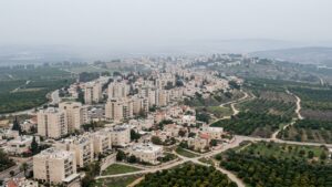
View of Holon in Israel
Holon Area Guide
Holon at a Glance City: Holon • Country: Israel • District: Tel Aviv • Population: 191829 • Area: 18.927 km² • Nearest major city: Tel Aviv • Distance: 6 km • Main transport connection: Ayalon corridor (Route 20 / Ayalon Freeway) and Israel Railways commuter links (Holon-Wolfson / Holon Junction) • Known for: Branded as a “Children’s City” (family attractions), Design Museum Holon, cultural institutions, a large industrial zone, and a small Samaritan presence in Neve Pinchas (noted in some local sources). • Historic origins: According to archaeological research, the area has evidence of ancient human activity; the place-name also...
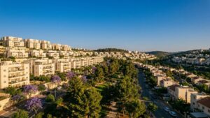
View of Ramat HaSharon in Israel
Ramat HaSharon Area Guide
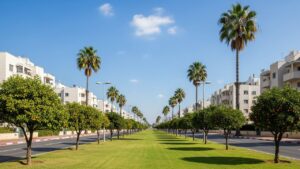
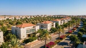
Ramat HaSharon at a Glance City: Ramat HaSharon • Country: Israel • District: Tel Aviv • Population: 48860 • Area: 16.792 km² • Nearest major city: Tel Aviv-Yafo • Distance: 9.2 km • Main transport connection: Road via the Glilot / Highway 2 corridor and an extensive local bus network; rail access via the nearby Herzliya Israel Railways station. • Known for: Affluent suburban residential character with tree-lined boulevards; historically known for strawberry fields and citrus groves; home to the Israel Tennis Center (Canada Stadium) and local cultural and educational institutions. • Historic origins: Archaeological evidence shows Byzantine and Early...
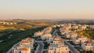
View of Tel Aviv in Israel
Tel Aviv Area Guide
Tel Aviv at a Glance City: Tel Aviv • Country: Israel • District: Tel Aviv District • Population: 494900 • Area: 52 km² • Nearest major city: Jerusalem • Distance: approximately 54 km • Main transport connection: Ayalon Highway (Highway 20) and the parallel Ayalon rail corridor, linked to Israel Railways and the central bus network • Known for: Mediterranean beaches and promenade, nightlife and cultural scene, the White City (Bauhaus/modernist architecture), a major high-tech/startup cluster and cultural institutions • Historic origins: Modern Tel Aviv was founded on 11 April 1909. The municipal area includes the ancient port of Jaffa...
Archaeologist examining ancient ruins at Thyatira in bright sunlight.
Thyatira: Location, Maps and Everyday Life
Textile production is one of the clearer economic signals found at the site. Archaeologists have recovered spindle whorls, loom weights, and small debris from workshops. Written notes from antiquity and later references sometimes point to cloth working and dyeing as local activities. Taken together, these types of evidence suggest clothmaking was an important part of the local economy. Geographical significance – where the city sat The settlement appears on a plain that links higher ground to the coastal lowlands. A river system in the wider area provided water for farming and for some crafts. Its position on a busy route...
Israeli archaeologist examines pottery at Philippi ruins with tools nearby.
Discovering Philippi Through the Lens of the Bible
What Is Philippi’s Significance in the Bible? Philippi is well known in Christian tradition because of its link to the Apostle Paul. The Acts of the Apostles records that Paul visited the town on his second missionary journey and that a Christian community formed there. Paul’s letter to the Philippians also shows a close bond with that group. The letter emphasizes themes such as joy, unity, and perseverance. The town’s place on regional routes made it a natural stop for travelers and missionaries. Because people passed through, new ideas moved with them. That helped the local community grow and made...
Archeologist examines ancient ruins at Dalmanutha, Israel, with tools.
Discovering Dalmanutha: A Historical Exploration
The quest to locate Dalmanutha is reminiscent of the search for the ancient city of Sodom. Both locations have sparked scholarly debate and exploration, driven by a desire to connect physical evidence with historical accounts. These efforts reflect a broader interest in understanding the historical context of ancient narratives. Where Is Dalmanutha Mentioned in the Bible? Dalmanutha appears in the Gospel of Mark. In this passage, Jesus returns from the region of Tyre and Sidon to the area surrounding Galilee. The exact location of Dalmanutha remains uncertain, with some scholars suggesting it was near the western shore of the lake....
Archaeologist in cargo pants examining stone ruins in Bithynia, Turkey.
Exploring Bithynia: Its History and Modern Location
The region sits between two important seas. This position shaped its economy and its contacts with neighbors. Over centuries, the area was a crossroads for local rulers, traders, and travelers. What Was Bithynia in Historical Times? Bithynia began as several local settlements that grew into a kingdom in the Hellenistic age. It was bordered by the Black Sea to the north and the Sea of Marmara to the west. The land was good for farming, with plains that supported grain, olives, and vineyards. Those products fed local people and were sold elsewhere. In the Hellenistic period, rulers such as Nicomedes...
Show all articles

All Authors

Rivki Green
David Pliner