Petah Tikva Area Guide

Petah Tikva is a long-established city in the Central District of Israel with a mix of residential neighbourhoods, industrial zones and key medical and cultural institutions. This guide summarises practical information about location, history, transport, schools and daily life to help you decide if the city suits your needs.
Petah Tikva at a Glance
City: Petah Tikva • Country: Israel • District: Central District • Population: 270403 • Area: 35.868 km² • Nearest major city: Tel Aviv • Distance: Approximately 10.6 km • Main transport connection: Highway 4 (Geha) plus suburban rail and a Red Line light‑rail branch via Kiryat Aryeh and Segula • Known for: Known as ‘Em HaMoshavot’ (Mother of the Moshavot); large industrial zones (Kiryat Aryeh, Segula, Kiryat Matalon); Rabin/Beilinson medical center; growing residential and high‑tech presence • Historic origins: Modern founding in 1878; the site also includes the archaeological mound Tel Mulabbis with remains from Roman through Late Ottoman periods
Insider's Guide to Israel
and can't-miss places most tourists never find.

Where Is Petah Tikva?
Petah Tikva sits in the Central District on the coastal plain east of Tel Aviv. It is part of the greater Tel Aviv metropolitan area and functions as one of the suburban and industrial hubs immediately surrounding the city.
Neighbouring municipalities include Ramat Gan, Bnei Brak, Kiryat Ono and Rosh HaAyin, with Kfar Saba a little farther to the northeast. The city is approximately 10–12 km by road from central Tel Aviv and is connected by major highways and suburban rail/light‑rail links.
Geographically Petah Tikva occupies sections of the Yarkon valley plain; historically the area included wetlands that were drained around the turn of the 20th century, and several urban parks and green spaces now sit within the built environment.
History of Petah Tikva
Petah Tikva’s modern history begins with its founding in 1878 by Jewish pioneers from Jerusalem; it is widely cited as the first modern Jewish agricultural settlement in the area and earned the nickname ‘Em HaMoshavot’ (Mother of the Moshavot). The early settlement faced challenges such as malaria and infrastructural hardship before expanding into a town.
On the same site lies the archaeological mound Tel Mulabbis, which records habitation and activity across many historical periods including Roman, Byzantine, Early Islamic, Crusader, Mamluk and Late Ottoman eras. Those remains indicate the location has been occupied intermittently for many centuries even though the modern town dates from the late Ottoman period.
Over the 20th century Petah Tikva developed through the Ottoman late period, the British Mandate era and into the State of Israel, moving from an agricultural origin toward more urban and industrial functions, with significant growth in housing, services and medical facilities in the modern era.
Petah Tikva Population
As of 2024 the municipal population is reported at 270,403 residents. That figure reflects the city’s role as a substantial suburban municipality within the Tel Aviv region.
Population trends over recent decades have seen growth driven by both housing developments and the expansion of employment opportunities in local industrial zones and services, making Petah Tikva one of the larger cities in the Central District by population.
What Is It Like to Live in Petah Tikva?
Living in Petah Tikva mixes suburban and urban qualities: residential neighbourhoods and family-oriented streets sit alongside sizeable industrial and commercial areas. The pace of life is generally practical and service-oriented, with daily life shaped by commuting patterns and local amenities.
Infrastructure and public services are well established: the city hosts a major medical complex, schools across all levels, shopping centres, sports facilities and a central bus station that functions as a transport hub. Local green spaces and parks provide outdoor options within the urban fabric.
Commutes to central Tel Aviv are relatively short by regional standards, and many residents combine work or study in the Tel Aviv area with living in Petah Tikva. The city suits households that want access to metropolitan jobs while retaining more space than central urban neighbourhoods.
Areas and Neighbourhoods in Petah Tikva
Petah Tikva comprises a mixture of older and newer neighbourhoods, each with distinct characters. The city includes historic cores, family-oriented districts and industrial zones that also provide employment. Below are the principal neighbourhood names commonly used in local planning and community descriptions.
Em HaMoshavot (Old and New)
Location and character: The Em HaMoshavot area references the original settlement core and adjacent development. The ‘Old’ quarter contains historic streets and some older housing stock, while ‘New’ sections are more modern.
Housing and transport: Housing ranges from older low‑rise buildings to newer infill developments. Road links to the rest of the city are straightforward and local bus routes connect to the central bus station and to nearby train/light‑rail nodes.
Who it suits: Residents who value proximity to the city’s historical centre and municipal services, including families and long‑term locals.
Kfar Ganim
Location and character: A largely residential district with family‑oriented streets and community facilities. It is one of the neighbourhoods commonly referenced for its day‑to‑day livability.
Housing and transport: The area offers a mix of apartment buildings and small private homes; local buses provide connections to the central parts of Petah Tikva and to adjacent municipalities.
Who it suits: Families and residents seeking quieter residential surroundings with easy access to schools and parks.
Segula
Location and character: Segula is known for its industrial and commercial activity alongside residential pockets. It forms part of the city’s employment base and industrial landscape.
Housing and transport: Residential areas around Segula tend to be practical and close to workplaces; the neighbourhood is served by suburban rail stops in the vicinity and local bus routes.
Who it suits: Workers employed in light industry, logistics or nearby commercial firms and those prioritising short commutes within the city.
Kiryat Aryeh
Location and character: Kiryat Aryeh is a major industrial and business district with increasing high‑tech presence alongside factories and offices.
Housing and transport: While primarily commercial, there is adjacent residential development; the area is served by suburban rail (Kiryat Aryeh station) and by major road links including Highway 4.
Who it suits: Commuters who work in local business parks and employees in manufacturing, distribution or tech firms.
Kiryat Matalon
Location and character: Another industrial and employment area within the municipal boundary, Kiryat Matalon hosts factories, warehouses and corporate premises.
Housing and transport: Residential sections near the zone offer pragmatic housing choices for employees; transport access is primarily by road with bus services linking to the city centre.
Who it suits: Professionals and blue‑collar workers seeking close proximity to local employers.
Ramat Verber
Location and character: Ramat Verber is a residential neighbourhood with amenities for daily life, reflecting typical suburban development patterns within the city.
Housing and transport: The area includes apartment buildings and community facilities and is integrated into the municipal bus network.
Who it suits: Families and residents looking for established residential areas with local services.
Amishav (Amishav–Hadr Ganim)
Location and character: Amishav and adjoining Hadr Ganim are residential sectors that combine modest apartment blocks with community infrastructure.
Housing and transport: These neighbourhoods provide practical housing options and are linked to main roads and bus lines serving Petah Tikva and surrounding towns.
Who it suits: Households wanting functional, well‑connected residential neighbourhoods with reasonable access to schools and parks.
Neve Gan
Location and character: Neve Gan is a residential neighbourhood noted in municipal listings, offering a mix of housing and local green space.
Housing and transport: The housing stock includes mid‑density apartment buildings; public buses serve the area and link to the city centre and transport hubs.
Who it suits: Residents who prioritise neighbourhood community life with nearby parks and schools.
Insider's Guide to Israel
and can't-miss places most tourists never find.
Central (city centre)
Location and character: The central area contains municipal services, shopping centres and cultural institutions. It functions as the administrative and commercial heart of Petah Tikva.
Housing and transport: A mix of older and modern residential buildings sits close to major amenities; the central bus station and local routes make this area highly accessible.
Who it suits: People who want immediate access to healthcare, retail, cultural venues and public transport.
Education in Petah Tikva
Petah Tikva runs a municipal network of primary and secondary schools and preschools. Municipal reporting notes around 127 schools and approximately 536 preschools and kindergartens, with local matriculation (Bagrut) rates in recent years around the high‑70s percent.
For higher education, residents typically look to colleges and universities in the broader Tel Aviv metropolitan area, which are accessible by short commutes. There are also vocational and continuing‑education options serving local students and adult learners.
Transport and Connectivity
Road access is a key feature: Highway 4 (Geha) provides a direct link west toward Tel Aviv, while Highway 5 to the north and Highway 6 to the east offer regional connections. Road distance to central Tel Aviv is approximately 10–12 km.
Rail and light rail: The area around Kiryat Aryeh and Segula is served by suburban rail services, and a Tel Aviv‑area Red Line light‑rail branch provides connections into the city with transfers available to reach central Tel Aviv by public transport.
Buses: An extensive local and intercity bus network operates in Petah Tikva, with major operators including Dan, Kavim and Egged. Petah Tikva Central Bus Station, located near the Beilinson/Rabin Medical Center, functions as the city hub.
Airport and car use: Ben Gurion Airport lies approximately 22 km from Petah Tikva. While some central neighbourhoods are well served by public transport, many residents use a car for daily convenience, especially for regional travel and for routes not directly covered by rail or light‑rail.
Nature and Outdoor Spaces
Petah Tikva includes several urban parks and green areas. Independence Park is a notable public space that contains recreational facilities, a small zoo and the Museum of Man and Nature.
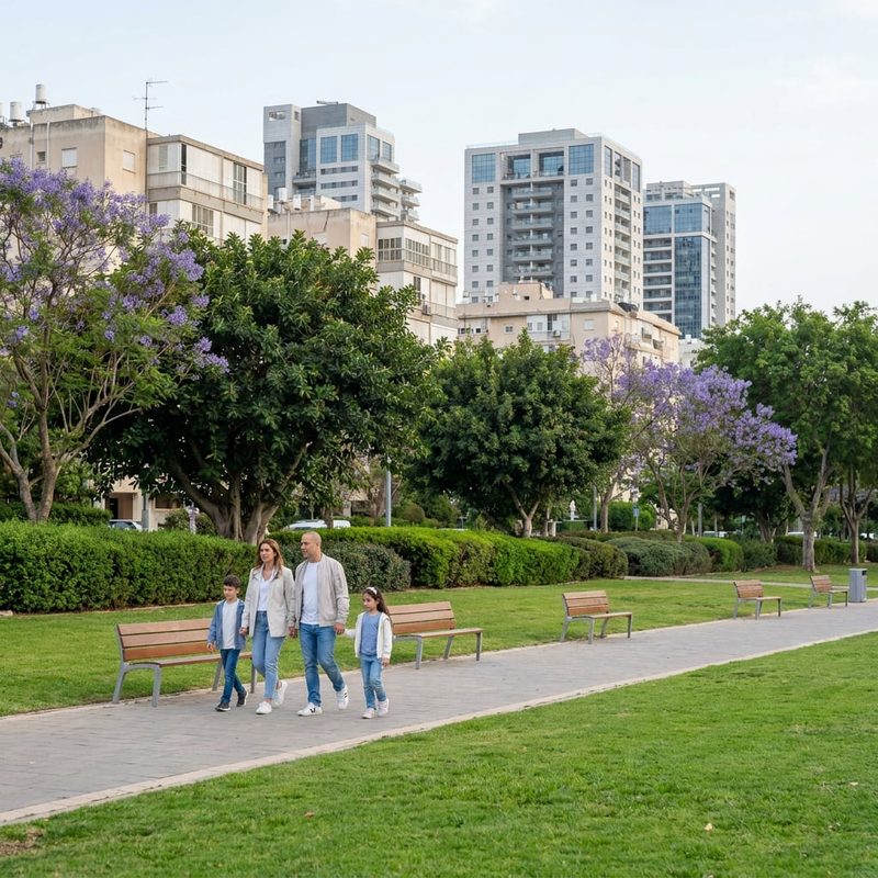
Historically the city sits on the Yarkon valley plain, and nearby traces of the former wetlands shaped early settlement and land use. Today the municipal parks and tree‑lined avenues provide residents with options for walking, jogging and family outings close to home.

Amenities and Things to Do in Petah Tikva
Petah Tikva’s largest healthcare institution is the Rabin Medical Center (Beilinson Hospital), which is both a medical and employment landmark. For cultural outings the Petah Tikva Museum of Art offers exhibitions and programming.
Shopping and leisure are concentrated around the Petah Tikva Grand Mall and several other shopping centres; local markets and dining options serve everyday needs across the city. Sports fans will recognise HaMoshava Stadium as a venue for football and events.
A few architectural and civic points of interest, such as the Santiago Calatrava pedestrian bridge near the hospital, add distinctive local landmarks. The combination of medical, retail and cultural amenities means many daily needs can be met within the city.
Cities and Towns Near Petah Tikva
Petah Tikva is closely surrounded by several well‑known municipalities that form the densely populated Tel Aviv conurbation and its immediate periphery.
Nearby cities and towns: Bnei Brak — 5 km; Ramat Gan — 6.2 km, approx. 5 min; Kiryat Ono — 6 km, approx. 15 min; Rosh HaAyin — 6.4 km; Kfar Saba — 12 km, approx. 11 min.
Advantages of Living in Petah Tikva
Proximity to Tel Aviv: Short road and rail/light‑rail connections make commuting and access to metropolitan jobs and services practical.
Medical and institutional services: Home to a major medical centre, which provides both healthcare access and local employment.
Employment base: Large industrial zones and business parks provide a wide range of employment opportunities within the city.
Established municipal services: A full range of schools, parks and shopping facilities support family life and day‑to‑day convenience.
Variety of housing and neighbourhoods: The city offers both older, established neighbourhoods and newer residential developments to suit different household needs.
Things to Consider Before Moving to Petah Tikva
Public transport coverage varies by neighbourhood: while some areas are well connected, other parts of the city rely more on private cars or transfers between bus and rail services.
Industrial zones nearby: Large employment and industrial areas bring jobs but also traffic and the urban characteristics associated with manufacturing and distribution.
Local entertainment: Compared with central Tel Aviv, late‑night and specialised cultural offerings are more limited, so some residents travel into the metropolis for a broader leisure scene.
Housing market dynamics: As a mature city in a high‑demand region, property values and availability can be constrained; buyers and renters should consult up‑to‑date local listings and planning resources.
Who Is Petah Tikva Best For?
Families
Petah Tikva suits families who want access to a wide municipal school network, parks and family services while remaining within easy reach of the Tel Aviv job market.
Commuters
The city works well for commuters to Tel Aviv and neighbouring employment centres thanks to short road distances and suburban rail/light‑rail connections at Kiryat Aryeh and Segula.
Young Professionals
Young professionals who work in nearby business parks or in Tel Aviv can find practical housing and reasonable commutes, plus local leisure and gym/sports options.
Students
Students often live in Petah Tikva while studying at colleges or universities in the greater Tel Aviv area, using public transport or a short car commute to access campuses.
Retirees
Retirees with a preference for accessible healthcare services and quieter residential neighbourhoods will find the city’s medical facilities and parks beneficial.
