
Eilat Area Guide
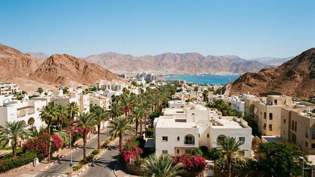

Eilat is Israel’s southernmost city. It is a desert and Red Sea resort town with warm-water beaches, coral reefs and abundant sunshine. This guide outlines Eilat’s history, neighbourhoods, transport links and everyday life for anyone considering moving there.
Eilat at a Glance
City: Eilat • Country: Israel • District: Southern District • Population: 57339 • Area: 84.789 km² • Nearest major city: Aqaba, Jordan • Distance: 6.7 km • Main transport connection: By road (Route 90 and connecting routes) and by air (Ramon/Eilat airport – ETM); regular intercity buses are the primary public transport link; there is currently no passenger rail to Eilat. • Known for: Israel’s southernmost city and a Red Sea resort. Noted for coral reefs and diving/snorkeling, warm beaches, desert scenery (Eilat Mountains & Timna), bird migration stopovers, duty-free shopping and a port. • Historic origins: The site has a long archaeological record with evidence of ancient occupation. The modern town was renamed Eilat in 1949 and saw municipal development in the 1950s.
Insider's Guide to Israel
and can't-miss places most tourists never find.
Where Is Eilat?
Eilat sits at the northern tip of the Red Sea on the Gulf of Eilat (Aqaba). The city lies between desert mountains and the sea and has a coastal-desert character.
Administratively Eilat is in the Southern District. Nearby coastal towns include Aqaba (Jordan) and Taba (Egypt). Within Israel, Be’er Sheva is the nearest major regional hub. The city’s location supports seaside tourism and links with coastal towns across the Gulf of Aqaba.
History of Eilat
The site of modern Eilat has a long archaeological record linked to an ancient port known as Elath or Ayla. The location was connected to regional trade in antiquity and has likely ancient remains in the general area.
Across medieval and Ottoman periods the area formed part of regional administrations. During the British Mandate the settlement was known as Umm al-Rashrāsh. The modern town received the name Eilat in 1949 and municipal development increased in the 1950s as the town grew as a planned tourism and service centre.
Eilat Population
As of 2023 the municipal population of Eilat was 57,339, a figure reported in official statistics for that year.
Eilat is small compared with Israel’s largest metropolitan centres. Its economy and services reflect a mix of permanent residents and seasonal visitors, and municipal planning addresses both resident needs and tourist demand.
What Is It Like to Live in Eilat?
Life in Eilat is shaped by its coastal-desert setting and tourism. Residents have access to beaches, coral reefs and nearby desert landscapes. The pace is generally more relaxed than in Israel’s larger cities.
Municipal services such as primary healthcare and schools are available in the city. For specialist medical care and higher education, residents commonly travel to regional centres such as Be’er Sheva. Urban amenities include a marina, a promenade, shopping areas and markets that serve both locals and visitors.
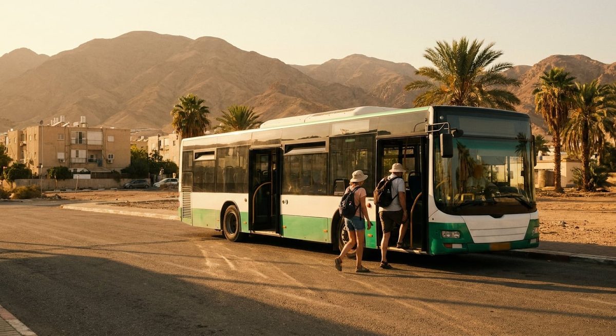
Local transport relies on buses, taxis and private cars. Intercity travel is mainly by road and air. Regular bus services link Eilat with Tel Aviv, Be’er Sheva and other cities. There is no passenger rail service to Eilat. The area suits people who prioritise outdoor recreation, sun and a coastal lifestyle and who are comfortable being distant from larger metropolitan service clusters.
Areas and Neighbourhoods in Eilat
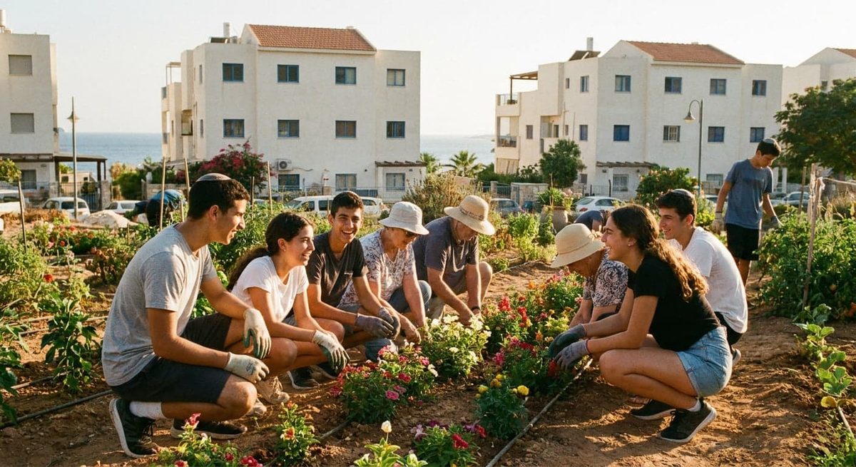
Eilat comprises several residential neighbourhoods and districts. Areas range from family-oriented quarters to parts close to the tourist spine. Housing includes apartment blocks and lower-rise family homes, with some newer development. Local buses and roads connect neighbourhoods to the central promenade and intercity bus station.
HaDekel (הדקל)
HaDekel is one of the city’s residential quarters. It mixes housing types and small shops. Local buses and short car trips take residents to the centre and the beachfront. Many families choose the area for its quieter streets and practical access to amenities.
Neve Midbar (נווה מדבר)
Neve Midbar reflects the desert setting in its name. The neighbourhood has a mix of apartments and family homes and is served by the city’s bus network. It is a practical choice for residents seeking affordable access to schools and everyday services.
Orim (אורים)
Orim contains local commerce and municipal amenities. It is close to internal transport routes and suits those who prefer straightforward urban living in a small-city environment.
Mitzpe Yam (מצפה ים)
Mitzpe Yam’s name suggests sea views or short distances to the shore. The neighbourhood combines family housing with nearby small retail and is popular with people who value proximity to beaches and the promenade.
Tze’elim (צאלים)
Tze’elim is a residential area with standard municipal provision for education and services. It is linked to other parts of the city by bus routes and local roads and is commonly home to families and longer-term residents.
Ofir (אופיר)
Ofir is a practical residential quarter popular with people working in local services and tourism. Commutes to central Eilat are typically short by bus or car.
HaEshel (האשל)
HaEshel is a family-oriented neighbourhood with access to schools and leisure facilities. Urban bus routes serve the area and residents use city services for routine needs.
Yaelim / Yaelim A (יעלים)
The Yaelim sectors are residential neighbourhoods shown on municipal maps. They accommodate a range of household types and are connected by the local bus network. They offer quiet streets with access to downtown areas.
Arava / Isidor (ערבה / איזידור)
Arava and Isidor form parts of Eilat’s dispersed neighbourhood pattern. Street layouts and housing vary. Residents rely on local services and the compact road network. These areas suit people working in tourism and local industry.
Tzofit Upper and Tzofit Lower (צופית עילית ותחתית)
These neighbouring subdivisions are used for municipal planning. They provide typical residential housing and community facilities and are linked to the rest of the city by buses and roads.
Ganot A and Ganot B (גנים א / ב)
The Ganot sectors are residential clusters with family housing and proximity to schools or small retail. They follow the city’s pattern of quiet residential streets with short journeys to beaches and services.
Shachmon area (שחמון)
The Shachmon area is another municipal residential zone with access to schools, local commerce and public transport. It is a short ride from Eilat’s commercial and tourist areas.
Education in Eilat
Eilat’s municipal Education Department runs primary and secondary schools. The system also includes vocational and special-education frameworks.
The municipality operates programs to support matriculation and technical training. For full university degrees, residents commonly look to regional academic centres outside the city, with Be’er Sheva the nearest major hub. Many students travel or relocate for higher education, while local vocational training supports employment in the city’s service sectors.
Insider's Guide to Israel
and can't-miss places most tourists never find.
Transport and Connectivity
Eilat’s main links to the rest of the country are by road and air. Route 90 is the principal road connection, with approaches from Route 40 and Route 12. Intercity buses operated by Egged and other carriers provide scheduled services to Tel Aviv, Be’er Sheva and other cities.
Ramon Airport (ETM) serves Eilat for domestic and some international flights. Ben Gurion Airport is the main large international airport used for many routes and lies several hundred kilometres to the north. There is no passenger rail service to Eilat; the nearest existing passenger railhead to the north is Dimona station. Various rail proposals to link Eilat have been discussed but were not in operation.
Driving distance to Tel Aviv depends on route and traffic; typical road journeys take several hours. Travel to Be’er Sheva by road is considerably shorter. Within the city, local buses and taxis are the common transport modes. Many residents find a car useful for flexibility, while others manage with urban bus services and occasional intercity trips.
Nature and Outdoor Spaces
Eilat sits where coral reef, desert and mountain meet. The coastline supports shallow coral reefs and protected marine areas such as the Coral Beach Nature Reserve.
Inland, the Eilat Mountains and Timna Valley offer desert geology, hiking and distinctive rock formations. The city lies on an important migratory bird route and is a recognised stopover for many species. Nearby nature reserves extend opportunities for wildlife observation, hiking and outdoor sports. These natural assets are central to resident life and the local tourist offer.

Amenities and Things to Do in Eilat
Eilat’s amenities combine tourism infrastructure with services for residents. Attractions that also serve local life include the Underwater Observatory Marine Park (Coral World), Dolphin Reef, the Eilat Marina and Promenade, and the Ice Mall.
Duty-free shopping and a range of restaurants and cafes cater to both tourists and locals. Healthcare services are available locally; additional specialist care can be reached in regional centres such as Be’er Sheva. Water-based activities (diving, snorkeling, sailing), beach sports and desert excursions are widely available.
Cultural programming is smaller than in Israel’s larger cities, but seasonal events linked to tourism add variety. Markets and local shops provide daily provisions, and the marina and promenade are popular leisure spots.
Cities and Towns Near Eilat
Eilat’s immediate neighbours include nearby coastal towns and regional Israeli centres. Aqaba in Jordan lies across the bay from Eilat. Taba in Egypt is also nearby. Within Israel, Be’er Sheva is the nearest major regional city and serves as a services and administrative hub for the Negev.
Nearby cities and towns: Aqaba, Jordan — 6.7 km, approx. 15 min; Taba, Egypt — 8.9 km, approx. 20 min; Be’er Sheva, Israel — 188.9 km, approx. 157 min; Tel Aviv, Israel — 282 km, approx. 240 min.
Advantages of Living in Eilat
Plenty of sunshine and easy access to beaches, coral reefs and desert recreation.
Tourism-driven amenities such as restaurants, leisure facilities and seasonal cultural programming.
Lower population density and more space; many residential areas offer larger living spaces and a more relaxed pace.
Proximity to coastal towns across the Gulf of Aqaba, noted here only as a geographic feature.
Things to Consider Before Moving to Eilat
Distance from national metropolitan services — some specialist medical, cultural and higher-education services are located in larger cities, mainly Be’er Sheva and centres farther north. Plan for travel time and cost if you need frequent trips.
Seasonal economy — tourism is a major local employer, so activity and jobs can fluctuate with seasons and international travel trends.
Limited passenger rail access — there is no operational passenger rail to Eilat, so intercity travel relies on road and air links.
Who Is Eilat Best For?
Families
Families benefit from a community-oriented lifestyle, municipal education provision and outdoor activities for children. The quieter pace and available space make it practical for family life.
Commuters
Daily commuting to national employment centres is lengthy. Eilat suits people whose work is local or who travel to regional hubs only occasionally.
Young Professionals
Young professionals in tourism, hospitality, diving or outdoor-recreation sectors will find direct job opportunities in a seasonal industry and a lifestyle focused on outdoor leisure.
Retirees
Retirees who prioritise sun, beaches and a relaxed pace may find Eilat attractive. They should consider the distance to some specialist medical services in larger regional centres.
